TrashMapper - iOS Project - Development - Part4
Table of Contents
Updates
Few more updates added…
-
Outline functionality for:
- CLLocation Manager & related delegates
- Mostly complete, major functionality included
- Camera usability, storing current photo
- Paths to photos, storage URL, etc
- userPost Object and related methods
- userPost structs and definitions
- Firebase cocoa pod integration
- Added, no analytics included for now. May integrate later
- CLLocation Manager & related delegates
-
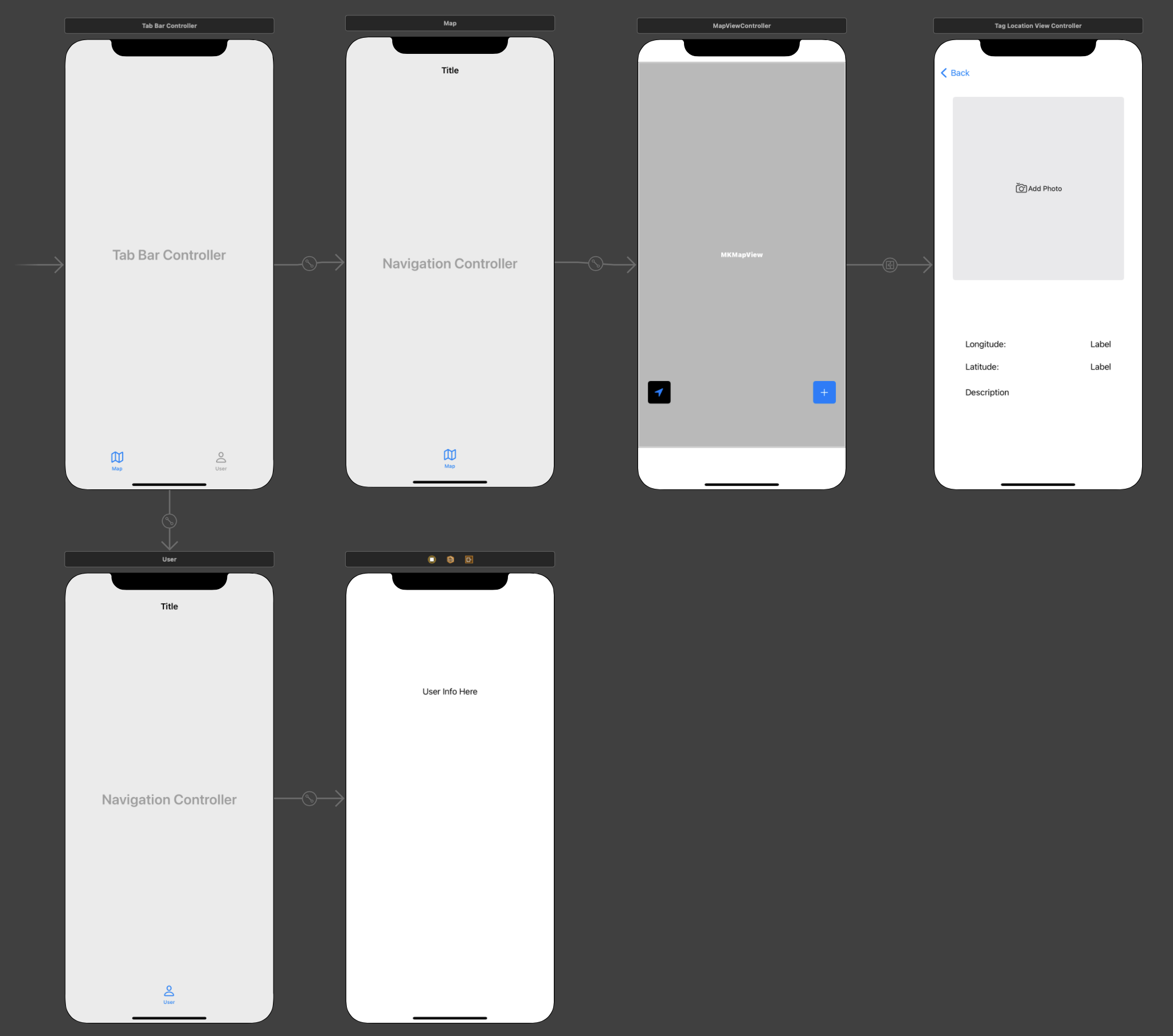
Build out the User Interface
- Add Apple Mapkit
- Added to unique view controller with tab
- Needs constraints on the view/tab
- Added in get user location button
- Function to zoom on user added
- Add tableBar with tableView, MapView, userProfile buttons
- In progress, two tab bars included
- May not do the tableView for initial release
- Add getUserLocation button
- Tag location view added with basic information
- Longitude
- Latitude
- Description
- Button for Image Picker
- Tag location view added with basic information
- Add addPost button
- Add Apple Mapkit
Updates to Views
Testing Zoom on User and Navigation to Tag Location
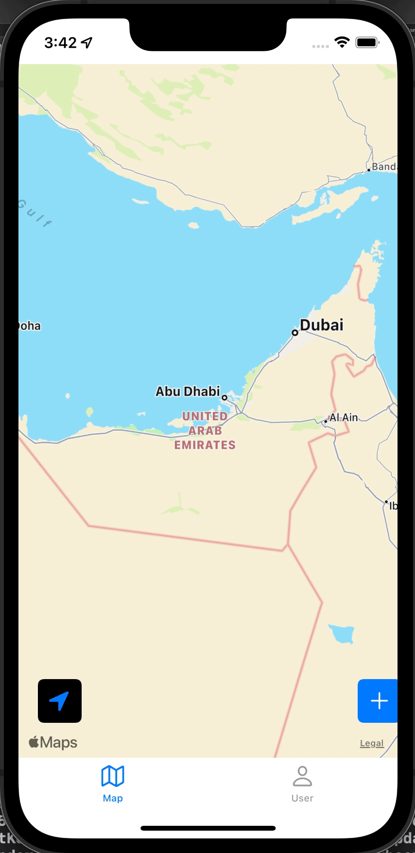
Zooming on user
To zoom in on the user, we first define a region with struct MKCoordinateRegion with initializer:
init(center: CLLocationCoordinate2D, latitudinalMeters: CLLocationDistance, longitudinalMeters: CLLocationDistance)
The CLLLocationCoordinate2D can be pulled from the mapview to point at user position.
Wrap this into a function and add an IBAction from the Arrow button so that it implies “zoom to user location”, similar to how Google maps does it.
@IBAction func getUserLocation {
  //create a region to zoom on
  let region = MKCoordinateRegion {
    center: mapView.userLocation.coordinate, //grab user coordinate
    latitudinalMeters: 1000,                 //lat span
    longitudinalMeters: 1000)                //long span
  }

  //Change to the region provided within this method
  mapView.setRegion(
    //adjust the region with proper aspect ratios and centerpoint
    mapView.regionThatFits(region),
    animated: true
    )
}